


Projects - Great Buddha Project
Nara Great Buddha | Kamakura Great Buddha | Wat Si Chum | Usuki Stone Buddha | Koumoku-Ten | Merced Church | Fugoppes
Nara Great Buddha
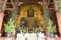
Great Buddha of Nara belongs to the Todai-ji Temple. This temple is located in the ancient capital of Nara, which is in Nara Prefecture, just south of Kyoto. The construction of Todai-ji, was completed in 752 with the aim, not only to house. Great Buddha image, but also to consolidate the position of the city as the capital and powerful center of Buddhism. The Great Buddha Hall, called “Daibutsu-Den”, the main hall of Todai-ji, was rebuilt several times. The current structure, completed in 1709, is only two-thirds of the original size, but is still the largest wooden building in the world. The seated figure inside is the world’s largest bronze image of Buddha. The Historic Monuments of Ancient Nara were registered as UNESCO World Cultural Heritage properties.
Scanning

In Nov.2000 and May.2001, we scanned the Great Buddha of Todaiji Temple by a Cyrax2500 laser range finder. The Cyrax2500 applies a time of flight and accurately measures the geometric model of visible surface on the static object. Therefore, the surface geometry of the Great Buddha is well preserved in the range data. Because the laser range finder captures only the visible surface, in order to obtain the entire surface, it is necessary to take range images from different directions. 114 range images were captured to create the complete model of the Great Buddha.
Result
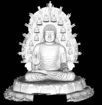
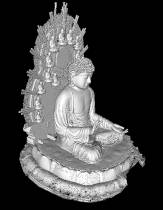
NAll range images are aligned into a common coordinate system and merged into a unified mesh model. The results are shown in the following images. The complete model of the Great Buddha contains approximately 1,560,000 vertices and 3,000,000 meshes.
Kamakura Great Buddha

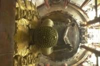
The Great Buddha of Kamakura is one of the most popular touristic sites in Kamakura. Kamakura, at only one hour’s train ride from Tokyo, is a beautiful city surrounded on three sides by the mountains and on one side by the sea. It used to be the center of the Shogunate from 12century.The great Buddha sits in the open air today, but it was once housed in a huge hall. The original temple was washed away by atsunami in 1495.
Scanning
In Nov.2000 and May.2001, we scanned the Great Buddha of Todaiji Temple by a Cyrax2500 laser range finder. The Cyrax2500 applies a time of flight and accurately measures the geometric model of visible surface on the static object. Therefore, the surface geometry of the Great Buddha is well preserved in the range data. Because the laser range finder captures only the visible surface, in order to obtain the entire surface, it is necessary to take range images from different directions. 114 range images were captured to create the complete model of the Great Buddha.
Result
The final 3D model of the Great Buddha is shown in the following figures. The finest model contains approximately 2,880,000 vertices and 5,650,000 meshes.
Phra Atchana and Wat Si Chum
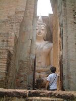
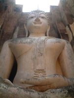
Wat Si Chum located in Sukhothai Province, Thailand, is the part of the Sukhothai Historical Park, which was recognized as the World Heritage in December 1991. It was built at the late half of the 14th century(Sukhothai Period). The main sanctuary received the influence from Mon and has the squared Mondop structure. It houses the massive seated stone Buddha, Phra Atchana(approximately 15m high and 11.5m wide). There is the passage through the roof inside the wall of the main sanctuary. Engraved Jakata tale are now located on the ceiling of the passage.
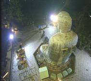
Scanning
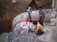
With the co-operation of Thai Department of Fine Art , the main sanctuary of Wat Si Chum and Phra Atchana was measured by laser scanner for their 3D models in March 2002. The roofless main sanctuary offers a little protection against the corrosion and algae from the tropical weather. The acquired 3D models can be referred to in the future reparation for their true size. In addition, the roof of the sanctuary can be visualized without physical construction.
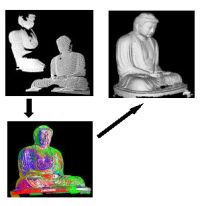
Result

114 sets of scanning data from Cyrax 2500 were used to create the model of the main sanctuary. While 68 sets of scanning data(67 from Cyrax 2500 and 1 from Lara 53500) were used for Phra Atchana. After a manual refinement, the final 3D model of the main sanctuary and Phra Atchana consist of 913,589 voxels(1,780,835 polygons) and 1,230,642 voxels(2,409,889 polygons), respectively. Samples of the final result are shown here.
Resulting Geometrical Model
- Structure Size(VRML format) Number of Polygon
- Main sanctuary 175,726 KB 1,780,835
- Phra Atchana 241,033 KB 2,409,889
Usuki Stone Buddhas
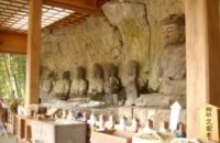
The Stone Buddhas in Usuki city, located in the western island of Kyushu, were designated as National Treasures in April, 1995, the first stone Buddhas to be named as such. They are called "Usuki Magai-Butsu," and consist of 59 individual Buddhas in total. These images are sculpted on soft cliffs made from lava or sand stone that abound in this area because of volcanic activities. Historians say that they were carved during the 12th to 14th centuries.
Scanning
In Dec. 2001, we tried to model these images with the cooperation of NARIPT and USUKI City. The purpose of this scanning is to detect the degradations or the progress of cracks by 3D range measurement techologies.
Cyrax2400 and MINOLTA VIVID 900 range scanner ware used to model large area (eoarse model), and small area (detail model), respectively. The latter was mainly used for one of the Buddha images that has been very damaged by so many cracks and exfoliations.
Acquired Range Images
- Cyrax 2400 (640000 points) , 7scans
- MINOLTA VIVID900 (300000 points), 224scans
Result
Acquired range images ware aligned to the same co-ordinate. They ware merged to from a complete model. The model was then manually refined. Follows are the samples of the final model.
Resulting Geometrical Model
- Sizd (in VRML file): 160,596KB
- Polygons: 3,285,809
Koumoku-Ten Clay Figure, Todaiji Temple
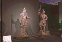
The Koumoku-Ten clay figure is one of the series of Buddism clay figures "Shitennoh (Four Kings in Heaven)" made in 8th century. Its height is about 150cm and the name means that he can hear all sounds in the world. All these 'Shitennoh' images are National Treasures and normally kept in Kaidan-In, Toudaiji Tepmle. Because these ones are fragile (made of clay), it is very rare to be moved outside of Kaidan-In.
On the June-July 2002, these figures are temporally moved to Nara National Museum for the purpose of the 1250th anniversary presentation of Toudaiji Temple. It was the first time in 17 years. During this presentation, we digitized this figure under the coorperation with Toudaiji Temple and Nara National Museum.
Scanning
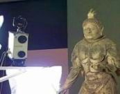
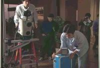
Koumoku-Ten clay figure is still having the surface colors that were painted at the time of manufacture. For these sorts of cultural properties, we have to archive geometry information, texture information and the relation of them at the same time. For this purpose, we used two kinds of sensors : geometrical scanners (Minolta Vivid900 and Cyrax) and super fine digital camera (Nikon D1X). The numbers of acquired range and color images are :
- Cyrax 2400 (640000 points) , 7 scans
- MINOLTA VIVID900 (300000 points), 224 scans
- NIKON D1X (2000 x 1800 pixels), 224 shots
Result
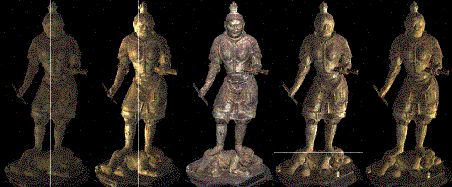
Acquired range images ware aligned to the same co-ordinate. They ware merged to from a complete model. The model was then manually refined. Left two images are the geometrical models of this figure. We have also developped the method to align the textures onto geometrical model. Due to the calibration, we can acquire the relation parameters of the range sensor and the image sensor. According to this parameter, we can map the texture images acquired by the image sensor onto the final geometrical model. Final texture-aligned computer graphics are showing below:
Resulting Geometrical Model
- Sizd (in VRML file): 160,596 KB
- Polygons: 3,285,809
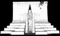
Facade of La Merced Church
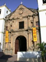
The Historic District of Panama City was registered as a World Heritage site in 1997. Panama City was first settled by Spaniards. Then it was destroyed by pirates to ruin. In the Historic District, a mixture of Spanish, French, and Early American style architecture is preserved. One of our objectives for measuring the church facade was to demonstrate a way to preserve and restore a cultural heritage using a laser range finder. It may replace the traditional way of recording such objects by manual measurement.
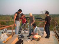
Scanning
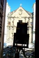
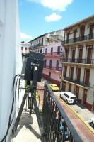
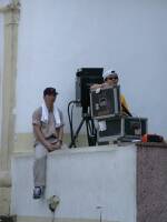
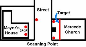
In February 2002, we acquired 3D data of the church facade with the cooperation of National Research Institute for Cultural Properties (NASRIPT), Tokyo, and Instituto Nacional De Cultura (INAC). The purpose of the scanning was to record, using 3D range measurement technologies, the present shape of the church, which waits for a future restoration. We used a Cyrax 2400 range scanner to scan large surfaces. We obtained a permission to measure the facade from the Mayor’s House, which stands across from the church. We had some problems in choosing the scanning points where we needed to set up the equipment, because the street between the church and the Mayor’s House was narrow and the church facade we wanted to scan was tall.
Acquired Range Images
- Cyrax 2400 (1000000 points) , 26 scans
Agreement

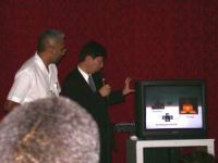
After the scanning, The ceremony was held in order to make the agreement of the cooperative heritage preservation between INAC and NARIPT, and then we presented our modeling in 3D digital form to Panamanian architects and students engaging in the preservation and restoration of historical heritage.
Result
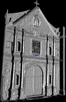
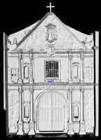
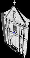
Acquired range images were aligned to the same co-ordinates. They were merged to form a complete model. The model was then manually refined. Here are a few samples of the final models. Click each image to display a larger image.
Resulting Geometrical Model
- Sizd (in PLY file): 50,216KB
- Polygons: 2,064,537
Fugoppe Cave Site
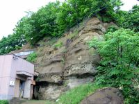
The Fugoppe Cave Site in Yoichi town, located in near Otaru, Hokkaido,was found in 1950 and designated as National Monument in 1953. It has the breadth of about 7m width, 6m depth, 5m height, and belongs to the history of Post-Jomon Period, about 1500 years ago. There are more than 200 attractive engravings on the wall surface, which represent humans, animals, boats, fishes, or humans masqueraded as animals. Such engravings are considered to strongly related to hoodooistic ritual, implying cultural relation with far north zone of Siberia or America.
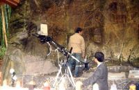
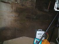
Scanning
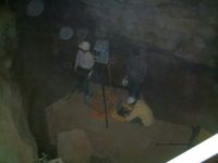
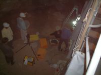
We tried to model some parts of small area (detail model) in the cave by MINOLTA VIVID 900 range scanner in Jun. 2002, and whole area (coarse model) by Cyrax 2500 in Sep. 2002, with the cooperation of Yoichi town.
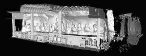
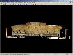
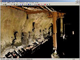
Result
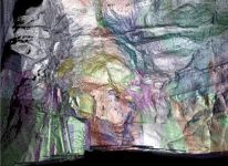
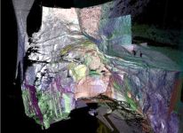
Acquired range images were aligned to the same coordinate. They were merged to form a complete model. Follows are the samples.